
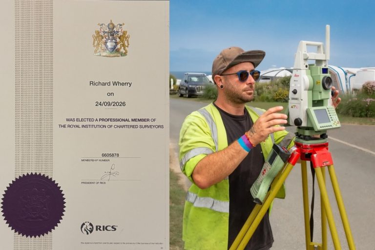
Congratulations to Rich on Becoming a Chartered Surveyor!
We’re so pleased to share that we have another Chartered Surveyor in our team.A big congratulations to Rich, who has

In construction, precision is everything. Whether it’s laying the foundation for a house, building a road, or installing utilities, accurate measurements and placements are crucial to ensuring the success of a project. At Kemp Engineering, one of the most critical tasks we perform is setting out.
Setting out may not be the most visible aspect of construction, but it is the backbone of a successful project ensuring that every element is built exactly where it needs to be, down to the millimetre. At Kemps, our team takes pride in delivering precise, accurate, reliable setting-out services that lay the foundation for every project.
So, what is setting out? In simple terms, setting out is the process of taking designs from digital plans and physically marking them on the site. The engineer marks the exact locations of structures, roads, utilities, and other key elements of a project onto the ground exactly where they were intended in the design phase. By ensuring that every part of the construction is correctly placed, setting out helps the project run smoothly, preventing costly errors, delays, and safety hazards. Typically, this is done using a combination of traditional tools like tape measures and plumb bobs, alongside modern equipment such as total stations, and GPS-based systems for precise placement of key points.
1. Coordinate extraction/creating of setting out data: The first step involves translating design drawings into coordinates in a format that can be understood by our equipment. During this stage, design interrogation takes place, where we thoroughly check that the drawings align with each other and ensure that the setting out plans are consistent and accurate across all elements. This process helps identify and resolve any discrepancies between the drawings before moving forward.

2. Establishing/checking original survey control: The first task on-site is to verify that the topographical survey, which the design was based on, aligns with the setting out. This ensures accuracy between the survey data and the design before any further work begins.
3. Setting out and Benchmarks: attending site to mark the first requirements as requested by the contractor. During the first visit we find out what setting out is wanted by the client before beginning work which usually starts with fence lines or footings. On this initial visit the engineer will establish level datums to ensure reliable and accurate level control are maintained throughout the project.
4. Future setting out visits to support the project: As the build progresses, a variety of elements are set out, including drainage systems, blockwork, kerb lines, and utilities to name a few. Each stage requires precise setting out to ensure all components are accurately positioned for the successful completion of the project.
5. Quality Control and Verification: Throughout the project ongoing checks are made to the site to verify measurements and ensure the project stays true to the drawings as it progresses. Some examples of this include Steel verticality for steel framed buildings, block work positions and drainage checks.
Depending on the complexity and size of a site a range of methods can be used to set out a project. Our engineers use the most appropriate techniques and tools on a job-by-job basis to make sure everything is done with efficiency and precision.
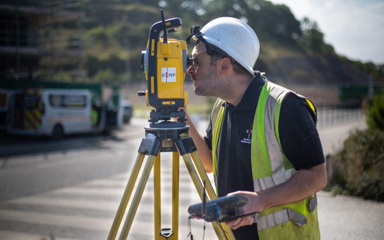
Total Station: This is the most common tool used for setting out anything which requires high accuracy. Total Stations are advanced instruments that measure both horizontal and vertical angles, as well as distances, ensuring precise positioning for various applications.
GNSS: A GNSS receiver utilises various satellite constellations, including GPS, Galileo, and GLONASS, to deliver accuracy within 30 mm without needing a direct line of sight to a total station. These receivers are invaluable for setting out lower-accuracy components of a project, such as bulk earthworks, fence lines, and landscaped areas.
Machine Control: This technology allows operators to excavate without relying on traditional setting out methods. Utilising either GNSS or Total Station systems, machine control accurately informs the equipment of its position. As a result, operators can excavate directly to a 3D model of the design, enhancing precision and efficiency on-site.
Precision is everything in construction. A single miscalculation in setting out can lead to delays, costly errors, or structural issues down the road. That’s why it’s a critical part of any project’s early stages. At Kemp Engineering, we understand the stakes and work carefully to ensure everything is right from the start.
Accurate setting out ensures that:
The project stays on schedule – avoiding costly reworks.
Materials are used efficiently, reducing waste.
The structure is safe and built to last, ensuring compliance with design standards and regulations.
Kemps approach to setting out reflects our commitment to accuracy, safety, and project success.

Our setting-out engineers are highly skilled, equipped with the latest in surveying technology. We use state-of-the-art Total Stations, GPS systems, and advanced software to ensure pinpoint accuracy. This technology allows us to map out a site, identify reference points, and transfer these data points to the ground with extreme precision.
For us at Kemps, setting out goes beyond just following a plan. We work closely with architects, engineers, and site managers to ensure a thorough understanding of the project. This collaborative approach means that if any potential issues arise, we can spot them early and address them before they become problems.
Setting out may happen behind the scenes, but its impact is felt throughout every stage of a project. At Kemp Engineering, we’re proud to play a key role in the success of our clients’ projects by providing accurate, dependable setting-out services. Our expertise, technology, and people-first approach ensure that we deliver the precision needed for every build.
We’re so pleased to share that we have another Chartered Surveyor in our team.A big congratulations to Rich, who has
Ian has been part of the Kemp team for nearly 20 years, joining us in March 2007 after studying Construction

We’ve just added two new vehicles to our ever-growing fleet, supplied by Hawkins Motors. With our team constantly on the


